📌 In this guide21 sections
- 1. The Great Rann of Kutch, Gujarat: a white desert that glows
- 2. Pangong Tso, Ladakh: the lake that changes colour
- 3. Living root bridges, Meghalaya: bridges that nobody built
- 4. The Umngot River at Dawki, Meghalaya: boats that float on air
- 5. Gandikota, Andhra Pradesh: India's Grand Canyon
- 6. Hampi, Karnataka: a kingdom among the boulders
- 7. Chandratal, Himachal Pradesh: the moon lake of Spiti
- 8. Loktak Lake, Manipur: the only floating national park in the world
- 9. The Valley of Flowers, Uttarakhand: a garden no one planted
- 10. Marble Rocks, Bhedaghat, Madhya Pradesh: a river of marble
- 11. Hunder, Nubra Valley, Ladakh: sand dunes in the Himalaya
- 12. Dhanushkodi, Tamil Nadu: a ghost town at the end of India
- Unreal places in India by season
- Three trips that link the most unreal places in India
- What does a trip to these places cost?
- What to pack
- Tips for photographing unreal places
- Unreal places in India for every kind of traveller
- Travel responsibly
- Which unreal place will you see first?
- Frequently asked questions
There are unreal places in India that make even seasoned travellers stop mid-sentence. Picture a flat white plain stretching to every horizon, crunching under your feet like fresh snow. There is no snow. The temperature is 25°C. As the full moon rises, the ground begins to glow a soft silver-blue, and people around you fall silent, because nothing in their lives has prepared them for a landscape like this. You are not on the Moon, or in Bolivia. You are in Gujarat.
India is so big and so varied that it hides entire worlds inside its borders: turquoise lakes in cold deserts, rivers so clear that boats seem to hover in mid-air, canyons that could pass for Arizona, and bridges that nobody built because they grew. Many Indians fly abroad to see "otherworldly" scenery, without realising that some of the most surreal landscapes on earth are a train ride or a short flight away.
We have picked 12 of the most unreal places in India, with what makes each one so strange, the best time to see it at its most magical, and how to get there. Warning: this list is likely to cause sudden holiday planning. Share it with the person you want to go with.
1. The Great Rann of Kutch, Gujarat: a white desert that glows
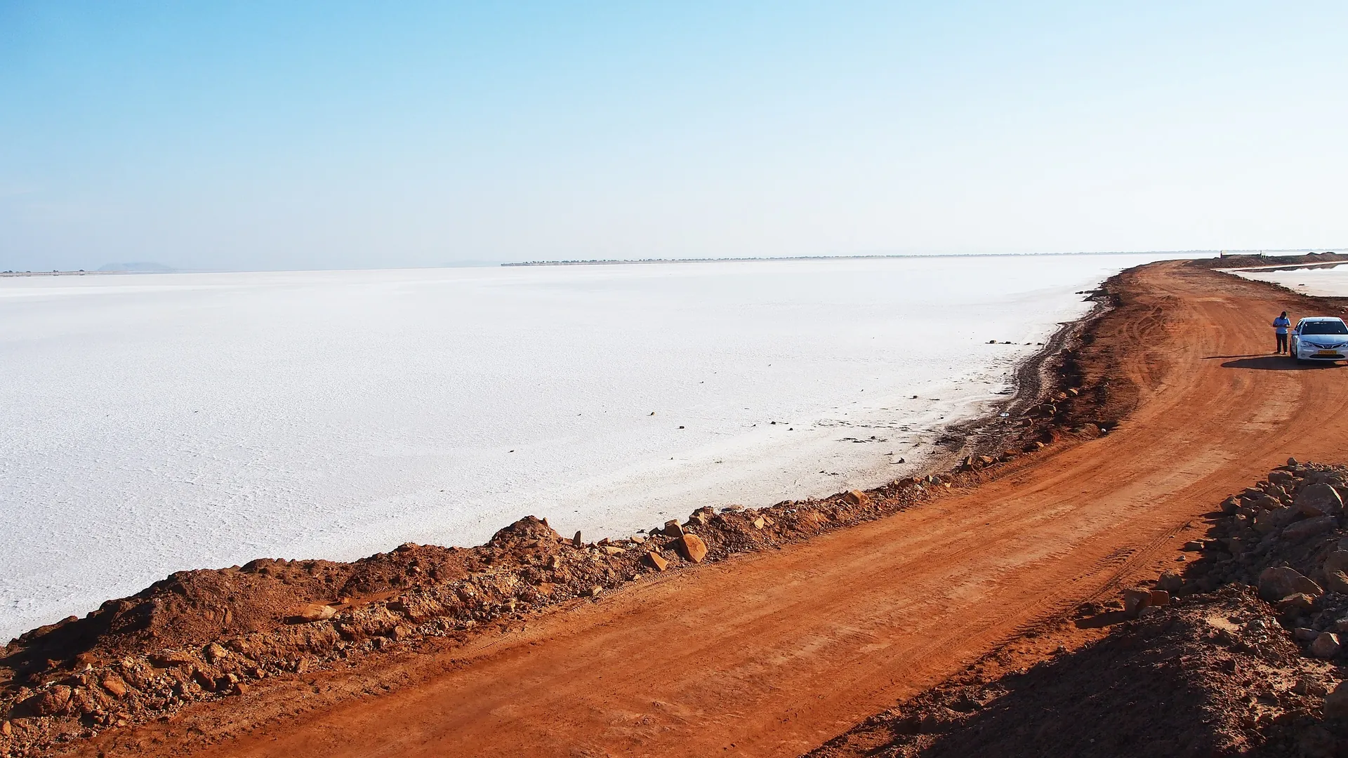
Why it looks unreal: the Great Rann is one of the largest salt deserts in the world, a vast, seasonal salt marsh near the border with Pakistan. During the monsoon it floods with shallow seawater. As the water evaporates in autumn, it leaves behind a crust of white salt that stretches for what feels like forever, cracked into hexagonal patterns. On a full moon night the whole plain shimmers in silver light.
When to go: November to February, when the salt is dry and firm. Plan your trip around a full moon for the most magical nights. The Rann Utsav festival, with a tent city, folk music and craft stalls, usually runs through this season near the village of Dhordo.
How to get there: fly or take a train to Bhuj, then drive about 80 kilometres north to the White Desert near Dhordo. You need a permit to enter the area, available online or at the checkpoint on the way. Do not miss Kala Dungar, the highest point in Kutch, for sweeping views, and the embroidery and craft villages around Bhuj.
2. Pangong Tso, Ladakh: the lake that changes colour
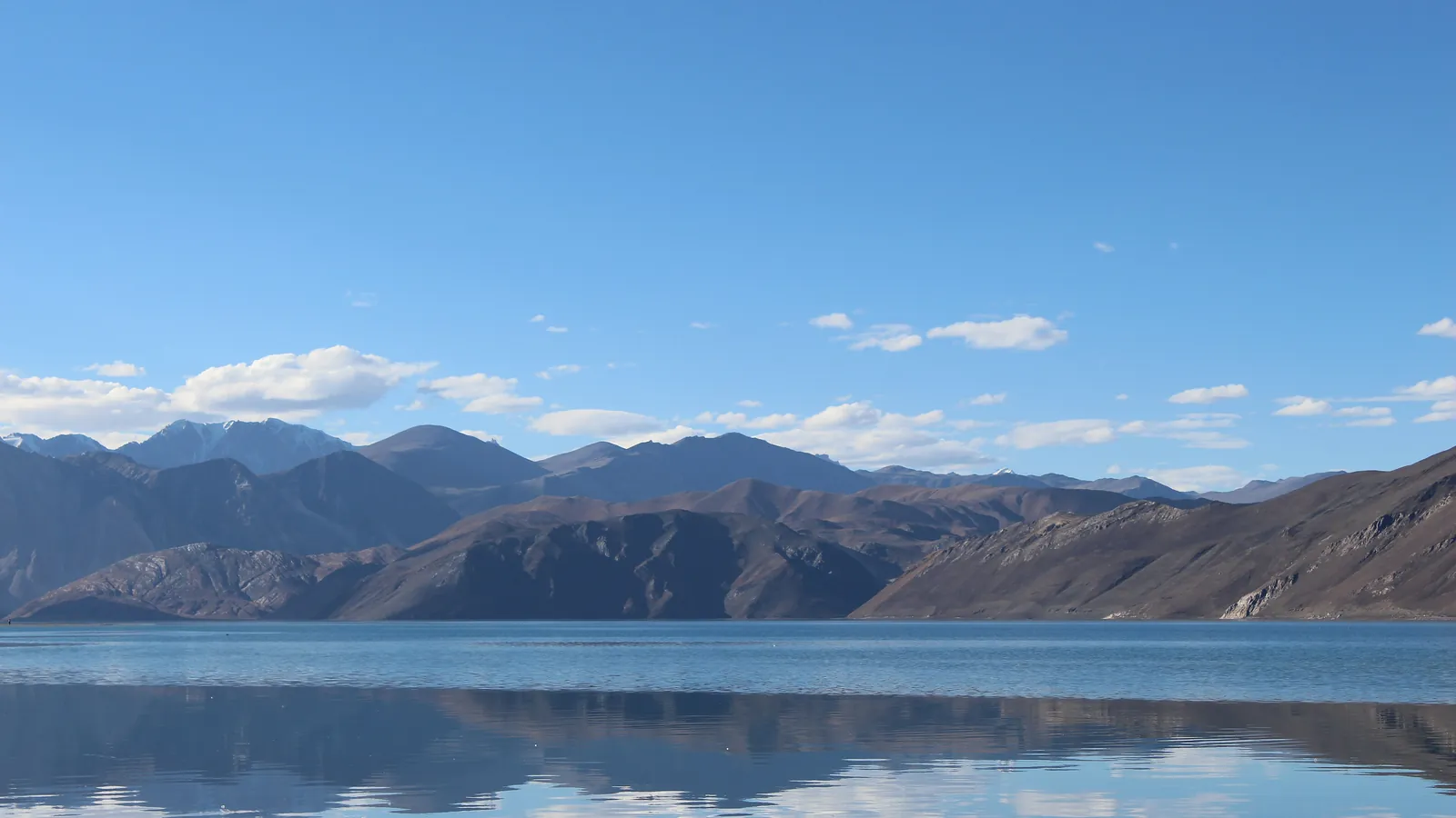
Why it looks unreal: at around 4,300 metres, in a moonscape of bare brown mountains, a long, narrow lake glows in impossible shades of blue. As clouds move and the sun shifts, the water changes from deep navy to bright turquoise to pale green, sometimes all at once. Pangong stretches for well over 100 kilometres, and most of it lies across the border in Tibet. In winter, it freezes solid.
When to go: June to September, when roads are open and the lake is at its most colourful. The famous final scene of the film 3 Idiots made it one of India's most photographed places.
How to get there: Pangong is about five to six hours by road from Leh, over the high Chang La pass. Indian visitors need an online permit for the Pangong area. Spend a night at a lakeside camp if you can: the sunrise and the star-filled night sky are unforgettable, though nights are freezing even in summer. Our Leh Ladakh bike trip guide covers the full route, and our Leh Ladakh High-Pass Motorbike Expedition rides it with you.
3. Living root bridges, Meghalaya: bridges that nobody built
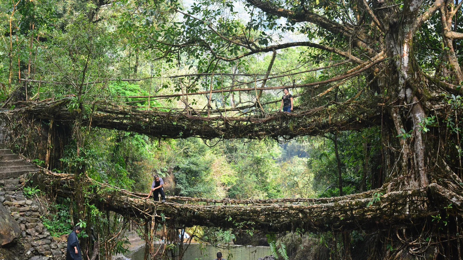
Why it looks unreal: in the rainforests of Meghalaya, the Khasi and Jaintia people have for generations guided the aerial roots of rubber fig trees across streams and gorges. Over 15 to 30 years, the roots thicken, intertwine and harden into living bridges strong enough to carry dozens of people, and they grow stronger with age. Some are believed to be centuries old. At Nongriat, one tree even forms a double-decker bridge, two levels of living roots stacked one above the other.
When to go: October to April, when trails are safer and less slippery. The monsoon makes the forests dramatic and the streams thunderous, but the steps can be treacherous.
How to get there: the double-decker root bridge is reached from Tyrna village near Sohra (Cherrapunji), about two hours from Shillong, down roughly 3,000 or more stone steps. The climb back up is a real workout; allow a full day or stay overnight in Nongriat. In 2022, India added the living root bridge landscapes to its tentative list for UNESCO World Heritage status.
4. The Umngot River at Dawki, Meghalaya: boats that float on air
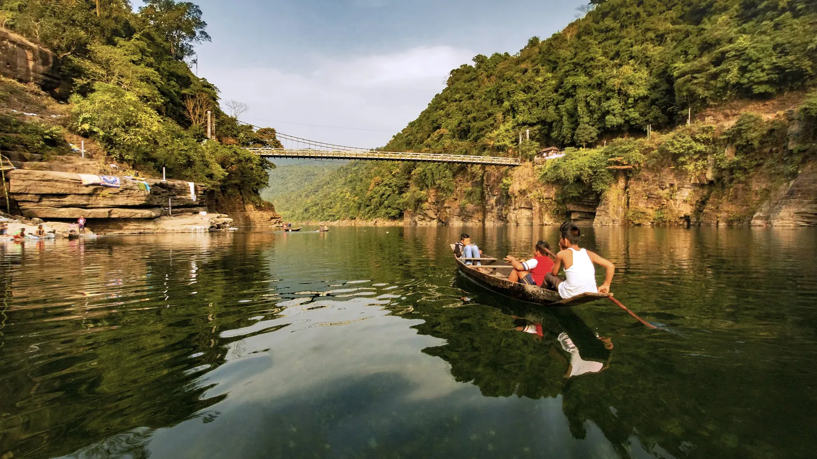
Why it looks unreal: in the dry season, the Umngot River near the Bangladesh border is so clear that you can see every pebble on the riverbed several metres below. Photographed from above, the wooden boats appear to be hovering in mid-air, their shadows falling on the stones beneath them. Many people see the photos and assume they have been edited. They have not.
When to go: November to April, when the water is at its clearest. During the monsoon, the river becomes muddy and fast.
How to get there: Dawki is roughly three hours by road from Shillong. Take a boat ride from the village of Shnongpdeng, where you can also camp by the river, go kayaking or try snorkelling. Combine it with a visit to Mawlynnong, often described as one of the cleanest villages in Asia, and its own living root bridge.
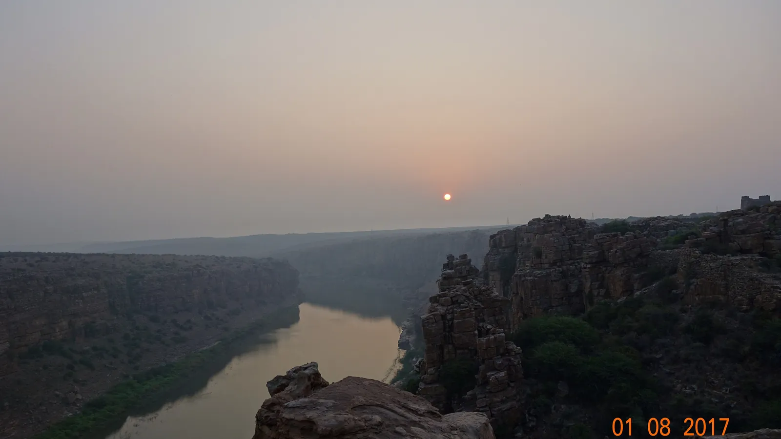
5. Gandikota, Andhra Pradesh: India's Grand Canyon
Why it looks unreal: in the dry hills of Kadapa district, the Pennar River has carved a deep gorge through red and pink rock, with sheer cliffs dropping to a winding green river far below. Standing on the edge at sunrise, it is easy to see why it is called the Grand Canyon of India. Perched on the rim is a medieval fort with a temple, a mosque, granaries and massive walls, adding a sense of history to the drama.
When to go: October to February, when the weather is pleasant. Summer is extremely hot.
How to get there: Gandikota is roughly five to six hours by road from Bangalore and about six to seven hours from Hyderabad. The nearest railway stations are Jammalamadugu and Muddanur. Camp near the gorge to be on the edge for sunrise, when the rocks glow orange and mist sometimes lies in the valley.
6. Hampi, Karnataka: a kingdom among the boulders
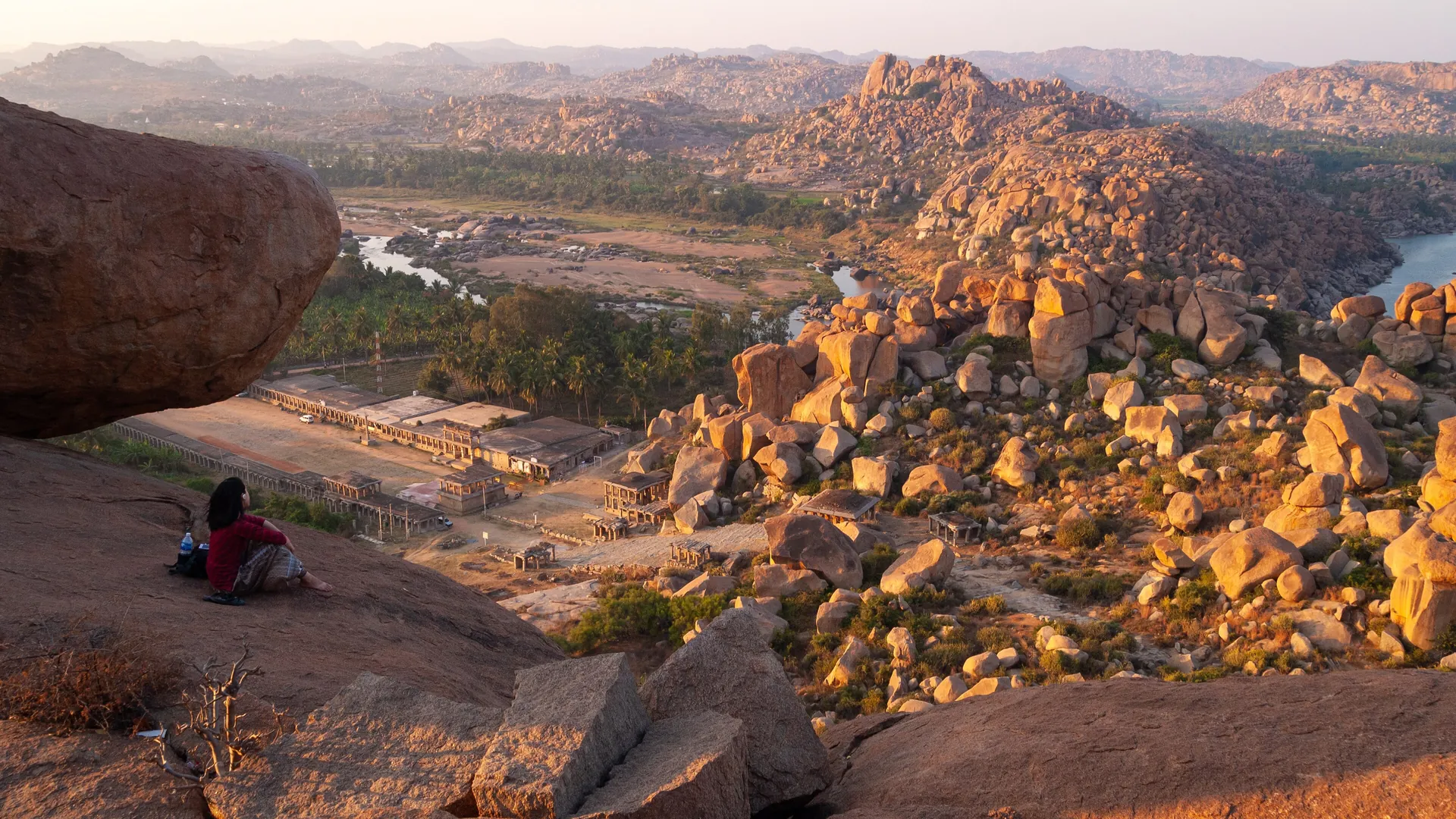
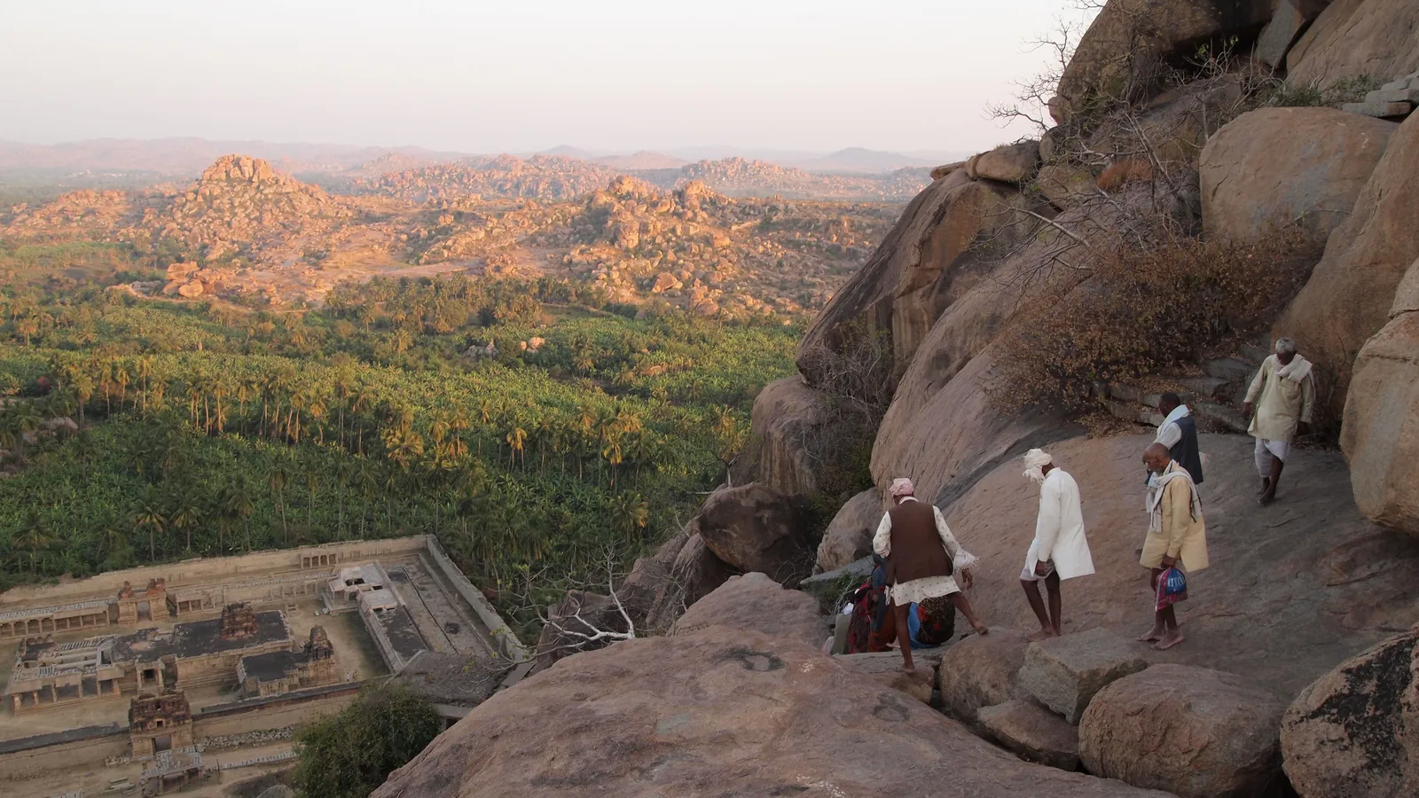
Why it looks unreal: Hampi's landscape looks as if giants had been playing with stones and left them lying about. Enormous granite boulders, some the size of houses, balance on top of each other on hills that stretch to the horizon, among banana plantations, rice fields and the Tungabhadra River. The rocks are made of granite that geologists date to around 2.5 billion years old, among the oldest rock on earth. Scattered through this landscape are the ruins of Vijayanagara, one of the richest cities in the world in the 15th and 16th centuries, now a UNESCO World Heritage Site.
When to go: October to February. Climb Matanga Hill or Hemakuta Hill for sunrise or sunset, when the boulders glow orange.
How to get there: Hampi is about seven hours by road or an overnight train from Bangalore to Hosapete, then a short drive. Rent a bicycle or scooter, take a coracle ride across the river, and see the Vittala Temple's stone chariot and musical pillars.
7. Chandratal, Himachal Pradesh: the moon lake of Spiti
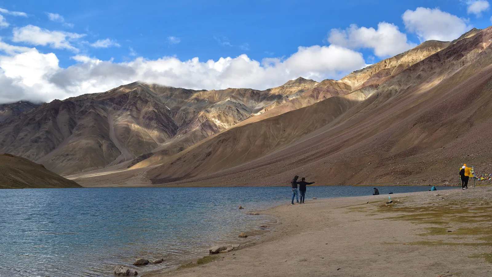
Why it looks unreal: Chandratal, the "Moon Lake", lies at around 4,300 metres in the barren mountains of Lahaul and Spiti. Shaped like a crescent, its water shifts from blue to emerald through the day, surrounded by meadows, scree slopes and snow peaks. At night, far from any city lights, the sky explodes with stars, and the Milky Way is clearly visible.
When to go: June to early October, when the road over the Kunzum Pass is open. Nights are cold even in summer.
How to get there: Chandratal can be reached by road from Manali via the Atal Tunnel and Batal, followed by a short walk. For adventurers, the classic way to arrive is on foot: the Hampta Pass trek crosses from green Kullu into the Spiti desert and often ends with a visit to the lake. Read our Hampta Pass trek guide, or join our Hampta Pass Himalayan crossover trek.
8. Loktak Lake, Manipur: the only floating national park in the world
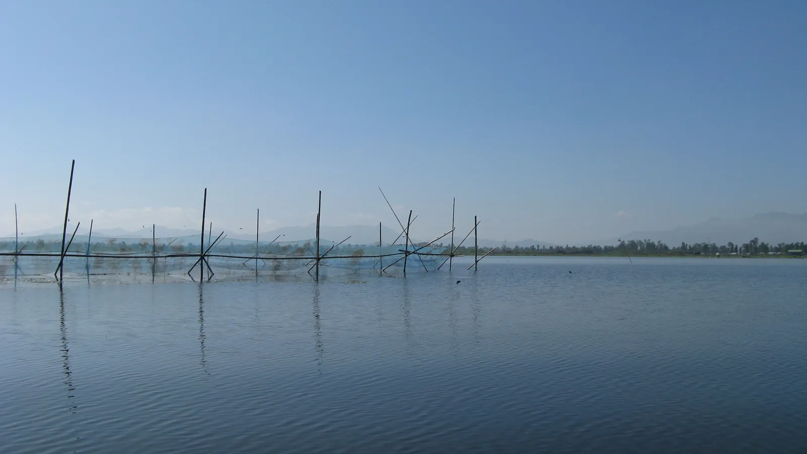
Why it looks unreal: Loktak, the largest freshwater lake in North-East India, is covered in floating islands called phumdis, thick mats of vegetation, soil and roots that drift on the water. Some are small circles used by fishermen; others are huge. The largest cluster forms the Keibul Lamjao National Park, the only floating national park in the world, home to the endangered sangai, a dancing deer found nowhere else on earth.
When to go: October to April, with misty mornings that make the lake look like a watercolour painting.
How to get there: Loktak is about an hour by road from Imphal. Visit Sendra island for views, take a boat among the phumdis, and look for the sangai at Keibul Lamjao in the early morning.
9. The Valley of Flowers, Uttarakhand: a garden no one planted
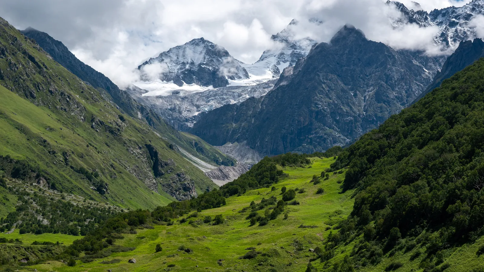
Why it looks unreal: for a few weeks each monsoon, a high Himalayan valley in Chamoli district bursts into a carpet of wildflowers: blue poppies, cobra lilies, primulas, orchids and hundreds of other species, framed by waterfalls and snow peaks. It was introduced to the wider world by the British mountaineer Frank Smythe, who stumbled into it in 1931, and it is now a UNESCO World Heritage Site together with the Nanda Devi National Park.
When to go: the park is usually open from June to October, with peak flowering from mid-July to mid-August.
How to get there: drive to Govindghat, beyond Joshimath, then trek to the village of Ghangaria and on into the valley. It is a moderate trek suitable for reasonably fit beginners. Many visitors also climb to the sacred lake and gurudwara of Hemkund Sahib nearby.
10. Marble Rocks, Bhedaghat, Madhya Pradesh: a river of marble
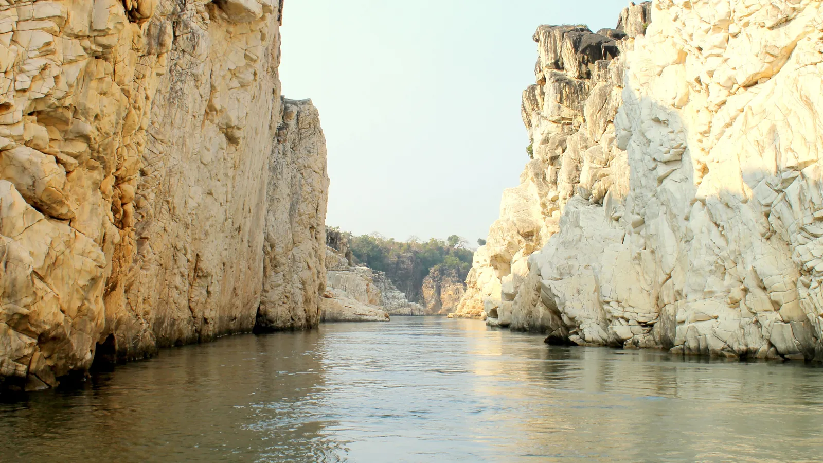
Why it looks unreal: near Jabalpur, the Narmada River flows through a narrow gorge of gleaming white, grey and pink marble cliffs that rise up to around 30 metres from the water. In sunlight, the stone sparkles; on full moon nights, the whole gorge seems to glow, and a boat ride between the cliffs feels like floating through a dream.
When to go: October to June. Boat rides are usually suspended during the monsoon when the river is high. Try to be there on a full moon night.
How to get there: Bhedaghat is about 25 kilometres from Jabalpur, which has an airport and major railway station. Visit the thundering Dhuandhar Falls, where the Narmada plunges in a cloud of spray, and the ancient Chausath Yogini temple on the hill above.
11. Hunder, Nubra Valley, Ladakh: sand dunes in the Himalaya
Why it looks unreal: after crossing one of the highest motorable passes in the world, you drop into a valley where rolling sand dunes lie between snow-capped mountains, and double-humped Bactrian camels, descendants of animals used on the old Silk Road caravans, wander across the sand. It is a desert and a mountain range in one frame.
When to go: May to September. Late afternoon is the best time to walk the dunes, when the light turns golden, the wind drops and the shadows of the camels stretch across the sand.
How to get there: Nubra is reached from Leh over the Khardung La, a drive of about four to five hours. Stay at a camp in Hunder or Diskit, and visit the giant Maitreya Buddha statue at Diskit monastery.
12. Dhanushkodi, Tamil Nadu: a ghost town at the end of India
Why it looks unreal: at the southeastern tip of Rameswaram island, a thin strip of sand runs out into the sea, with water on both sides. At its end lie the ruins of Dhanushkodi, a busy town that was destroyed by a cyclone in 1964. The shells of a church, a railway station and a post office stand among the dunes, and the road ends at Arichal Munai, where two seas meet and Sri Lanka lies only a few dozen kilometres away across the water.
When to go: October to March. Avoid stormy weather and visit in daylight.
How to get there: drive or take a bus from Rameswaram, about 20 kilometres away. Getting to Rameswaram is an adventure too: the train crosses the sea on the Pamban Bridge, one of India's most spectacular rail journeys. We feature it in our list of the world's most scenic train journeys.
Unreal places in India by season
- Winter (November to February): Rann of Kutch, Gandikota, Hampi, Dawki, the living root bridges, Loktak, Dhanushkodi.
- Summer (May to September): Pangong Tso, Nubra and Hunder, Chandratal.
- Monsoon (July to August): the Valley of Flowers.
- Full moon nights: the White Rann of Kutch and the Marble Rocks at Bhedaghat.
Three trips that link the most unreal places in India
The North-East loop (8 to 10 days)
Fly into Guwahati and drive to Shillong. Spend two days around Sohra (Cherrapunji) for waterfalls, caves and the double-decker root bridge at Nongriat. Continue to Dawki and Shnongpdeng for the crystal-clear Umngot, with a stop at Mawlynnong. Then fly or drive on to Imphal for Loktak Lake and Keibul Lamjao. The region is green, uncrowded and wonderfully friendly, and the food, from Khasi jadoh to Manipuri eromba, is a discovery in itself.
The high-altitude loop (9 to 12 days)
Fly into Leh and rest for two full days to acclimatise, because altitude sickness is a real risk. Visit Magnetic Hill and the monasteries of the Indus Valley, then cross the Khardung La to Nubra and the dunes of Hunder, continue to Pangong Tso, and return to Leh over the Chang La. With extra time and a head for adventure, drive on towards Spiti via Manali and the Atal Tunnel to reach Chandratal.
The southern loop (6 to 8 days)
From Bangalore, drive to Gandikota for sunrise over the canyon, continue to Hampi for two or three days among the boulders and temples, and finish with a stop at Lepakshi and its hanging pillar on the way back. Add an overnight train south to Rameswaram, crossing the Pamban Bridge, for Dhanushkodi at the very end of India.
What does a trip to these places cost?
- Stays: homestays and camps typically cost ₹1,500 to ₹4,000 per night; comfortable hotels ₹4,000 to ₹10,000; festival tents at the Rann Utsav and luxury Ladakh camps more.
- Transport: a car with driver usually costs ₹3,000 to ₹6,000 per day depending on the region and terrain. Ladakh and the North-East are pricier because of distance and road conditions.
- Permits and entry fees: Pangong, Nubra and the Rann need permits, and national parks such as the Valley of Flowers charge entry fees. Budget a few hundred to a few thousand rupees per person.
- Food: simple local meals cost ₹200 to ₹600 per person; more in tourist hotspots.
What to pack
- Layers: high-altitude deserts are hot in the sun and freezing at night. Pack a down jacket, thermals, a woollen cap and gloves for Ladakh and Spiti, even in July.
- Sun protection: strong sunscreen, sunglasses and a hat. The glare off salt, snow and high-altitude lakes is intense.
- Good shoes: trekking shoes with grip for root bridges, boulders and wet trails.
- Rain gear: a poncho and waterproof bag covers for Meghalaya and the Valley of Flowers.
- Cash: ATMs and card machines are scarce in remote areas.
- A basic medical kit, including medication for altitude sickness, after consulting your doctor, and rehydration salts.
Tips for photographing unreal places
- Go for golden hour. The hour after sunrise and before sunset turns boulders orange, lakes turquoise and salt silver.
- Use a polariser. It deepens blue skies and cuts reflections, making clear water like the Umngot and Pangong look even more unreal.
- Include a person. A tiny figure on the salt or beside a boulder shows the true scale.
- Look up at night. Chandratal, Pangong, Nubra and the Rann have some of India's darkest skies. A simple tripod and a phone's night mode can capture the Milky Way.
- Respect the rules. Drones need permission in many areas, and are banned near borders and in national parks.
Unreal places in India for every kind of traveller
- For couples: a full moon night in the White Rann, a boat between the marble cliffs of Bhedaghat, or a lakeside camp at Pangong.
- For families: Hampi's boulders and coracle rides, the clear water at Dawki, and the Rann Utsav's cultural evenings.
- For adventurers: the steps down to Nongriat, the Hampta Pass trek to Chandratal, and a motorbike ride over the Khardung La.
- For photographers: sunrise at Gandikota, misty mornings on Loktak, and the Valley of Flowers in full bloom.
Travel responsibly
Many of these places are fragile. The salt crust of the Rann, the meadows of the Valley of Flowers, the root bridges of Meghalaya and the high-altitude lakes of Ladakh can all be damaged by careless visitors. Carry your rubbish out, stay on marked paths, do not carve names on rocks or roots, avoid single-use plastic, and support local guides, homestays and craftspeople, whose communities have protected these places for generations.
Which unreal place will you see first?
You do not need a foreign passport stamp to feel like you have landed on another planet. From Gujarat's glowing salt to Meghalaya's living bridges, India's most unreal places are waiting to be discovered, and every one of them makes a story worth telling.
Curious for more? Read about the mysterious places in India with stories stranger than fiction, or browse all our tours and weekend getaways. And send this list to the friend who keeps saying "we should go somewhere different this year".
Frequently asked questions
What is the most unreal place in India?
The White Rann of Kutch on a full moon night is often described as the most otherworldly sight in India, alongside the colour-changing Pangong Tso in Ladakh and the crystal-clear Umngot River at Dawki in Meghalaya.
When is the best time to visit the White Rann of Kutch?
November to February, when the salt crust is dry. Plan around a full moon for the most magical nights, and check the dates of the Rann Utsav festival.
Why does the water in Dawki look so clear?
In the dry season from November to April, the Umngot River carries very little sediment, so the water becomes extremely clear and boats appear to float in mid-air. In the monsoon it becomes muddy.
Do I need a permit for Pangong Lake?
Yes. Indian visitors need an online permit for the Pangong area in Ladakh, which can be arranged before the trip or in Leh.
How are living root bridges made?
Khasi and Jaintia communities guide the aerial roots of rubber fig trees across streams over 15 to 30 years until they intertwine and harden into strong living bridges that can last for centuries.
Which is the Grand Canyon of India?
Gandikota in Andhra Pradesh, where the Pennar River has carved a deep gorge through red rock beside a medieval fort, is called the Grand Canyon of India.
What is special about Loktak Lake?
Loktak Lake in Manipur is covered in floating islands called phumdis and contains Keibul Lamjao, the only floating national park in the world and home to the endangered sangai deer.